


Pride in Our Past & Present
Settled by a group of Scottish Presbyterians beginning in the 1680’s, Matawan was first called New Aberdeen, and then Mount Pleasant. Today, Matawan’s historic town core retains its appeal as a place to live, work, and shop.
America’s 250th Birthday celeBRATION
 The Borough of Matawan has adopted the 250-Resolution formally announcing Matawan’s participation in the upcoming 250th birthday celebration of the United States of America.
Special Announcement: The Matawan Historical Society is pleased to announce that it is collaborating with the Keyport Historical Society on a series of special events celebrating the 250th Anniversary of the American Revolution. This includes co-sponsoring related lectures in our regular monthly meeting series, as well as partnering on special events commemorating the local fight for independence in the Bayshore area. Both Matawan and Keyport are proud partners in the RevolutionNJ and MonmouthNJ 250 programs.
Matawan and Keyport’s first collaborative event will be John Schneider’s lecture “The Deadly Divide: America’s First Civil War During the American Revolution” on January 26, 2026. A complete list of our upcoming events will be published soon.
Burrowes Mansion History
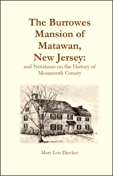 The new edition of The Burrowes Mansion of Matawan New Jersey: and Notations on the History of Monmouth County, Second Edition (2023) by Mary Lou Diecker and Barry C. Orr is now available! The Burrowes Mansion, constructed in 1723, celebrated its 300th Birthday in 2023, and this newly expanded edition of the book commemorates that anniversary. Please visit our “Shop” page to order your copy.
Facebook News
Mark your calendars Bayshore! ⚓
The Great Whaleboat Races of 2026 are coming to Lake Lefferts Park in Matawan on Saturday, August 29th, 5:00–7:30 PM.
Three towns. Three whaleboats. One race to “capture” the mayors of Aberdeen, Keyport, and Matawan — all in celebration of America’s 250th anniversary.
Music, food, kids’ games, inflatables, and colonial reenactors round out the evening. Free and open to everyone.
📍 Lake Lefferts Park, Ravine Drive & Matawan Ave
Questions: Recreation@matawanborough.com
More details go come!
Borough of Matawan, NJ
Aberdeen Township
Keyport Historical Society
Keyport Yacht Club
#MatawanNJ #AberdeenNJ #KeyportNJ #America250 #WhaleboatRaces #MatawanHistoricalSociety #JerseyShoreEvents #ThingsToDoNJ #MonmouthCountyNJ #RevolutionaryWar

1 CommentsComment on Facebook
🏛️ FREE Burrowes Mansion Tours TODAY! 🏛️
Join us this afternoon from 2-4 PM for a free guided tour of the historic Burrowes Mansion! At 303 years old, this remarkable home was already standing 9 years before George Washington was even born! Imagine everything these walls have witnessed.
Tours are held every 1st and 3rd Sunday of the month, so if you can’t make it today, mark your calendar for next time!
📍 Burrowes Mansion, Matawan, NJ
🕑 2:00 PM - 4:00 PM
💰 FREE — all welcome!
We hope to see you there! 🇺🇸
#BurrowesMansion #MatawanHistory #NJHistory #FreeEvent #ThingsToDoNJ #MonmouthCounty #HistoricHomes #SundayFunday
1 CommentsComment on Facebook