by Pat Noble
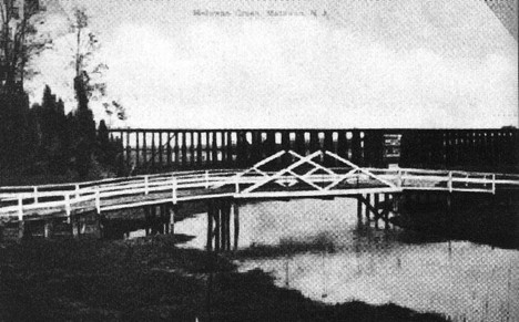
(Above – Figure 1. This circa 1905 image of the trestle includes the Aberdeen Road bridge over Matawan Creek in the foreground.)
The construction of railroad bridges at the Raritan River, Cheesequake Creek and Matawan Creek was an important part of getting rail service to Matawan in the months leading up to the opening of the New York and Long Branch line on July 1, 1875. (a)
A week earlier, a Matawan Journal correspondent covered the invitation-only first run of the line, which took place on June 25, 1875. Below are selected excerpts from the journalist’s account of the trip between the Raritan River and Matawan.
“Reaching the draw over the Raritan, a delay of some moments was taken, for the purpose of allowing the excursionists to get out and witness its working. This grand structure is truly the mammoth triumph in civil engineering – the great bridge and the longest draw in the world, — opening and closing with its great wrought-iron jaws, the mouth of the Raritan river, . . . “(a)
“The draw over Cheesequake creek is a pygmy in comparison with the one which last excited our wonder and admiration; but it is a fine iron structure, though so small, and is said to work to a charm. It is located about a stone’s throw further up the creek than the county draw over the same stream [today’s State Route 35 drawbridge].” (a)
“And now we pass along a rolling country, through deep cuts , and over fills which cross romantic ravines, until we pass the Middlesex county line, and enter our beautiful agricultural Monmouth. In almost less time than we write it the screech of the locomotive tells us we are nearing Matawan, and in a moment the broad meadow through which the Matawan creek leads its serpentine course, is in full view, and we feast our eyes upon the really pretty hill slopes on either side , while a little way southward, nestling almost hidden among the trees, is our own beloved Matawan, beautiful for situation and the joy of every one who has lived long enough among its people to become acquainted. Crossing the high trestle (35 feet) we draw near to Matawan depot . . .” (a)
The construction of a Matawan Creek railroad trestle without a draw was a tough decision as it involved a meaningful change to the head of navigation. Long a port town, Matawan would now be a railroad hub, its commitment to the steamboat significantly reduced. The correspondent reflected on the history of navigation at Matawan. (b)
“The time was, when the head of navigation was at the bridge that crosses to Mr Peter V Hyer’s farm, and the bridge on the Morristown road [Ravine Drive today] had a draw in it, but the filling up of the creek at that part necessitated the change of location further down. The steamer Argo used to make her regular trips to the wharf by J H Hornor’s lime-sheds; but now such a thing would be impossible; and yet Matawan prospers nonetheless.” (b)
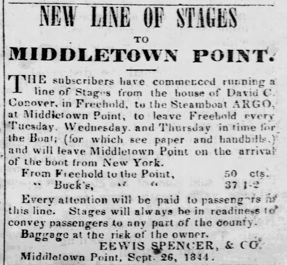
Figure 2 Advertisement, Monmouth Democrat, 28 Nov 1844
The New York and Long Branch Railroad needed to build a trestle that would span at considerable height the meadows between what is now Matawan Avenue and Main Street. The trestle would have been too tall to include a draw in the center for boat traffic on Matawan Creek. Instead, a “tight” design was the preferred option, meaning that the railroad bridge would keep tall ships from reaching docks closer to downtown Matawan. (b)
“[The] height of the structure was a very important reason for making it tight. The pilings were first driven about seventy feet before a solid bottom was struck, and on these is constructed a trestle thirty-five feet high. It can be readily seen how improper it would have been to weaken such a high crossing just at the central point, where it should be strongest, by insisting upon a draw.” (b)
The railroad company agreed to increase docking facilities north of the trestle. (b)
“It is true, some of the smaller craft might have gone beyond the trestle-work if a draw had been placed in it; and yet this, connected with the fact that they can unload a little further down, is a small consideration, in comparison with the greater security against accident by a tight bridge.” (b)
The railroad promised to provide competitive pricing for businesses closer to town that would no longer receive shipping services at their docks. (b)
“We are gratified therefore, to know that those property owners who hold docking interest and whose business is largely above the trestle, are willing the structure should be without a draw, since the company have guaranteed to compensate by having their merchandise delivered just as cheap as if the vessel could have run up to their docks.” (b)
Keyport had vied to direct the railroad line into their borough, offering a lower crossing of Matawan Creek at Brown’s Point, but Matawan won the battle. (b)
“The main question at issue was, after all, — shall the road go between the lower toll-gate and Brown’s Point, over a mile away, with a draw, or will the inducement of a tight bridge bring it directly to our town. The majority of the directors said if there must be a draw, the road must go below, for the line will be more nearly straight and the distance slightly shortened; but by strong promises of a tight bridge the road was located as at present, with the depot right at our town. Of course, in this light of the question, no businessman in Matawan would have been so blind to his own interests as to have sent such an important line of travel over a mile away from our town limits, and within the corporate limits of Keyport.” (b)
In the Spring of 1929, the New York & Long Branch Railroad rebuilt the Matawan Creek trestle. The wooden infrastructure likely needed to be replaced due to age to remain sound. In this case, the railroad delivered several carloads of lumber to Matawan in March in preparation for the reconstruction of “the railroad bridge between Matawan Borough and Cliffwood” over “the Matawan meadows” “before the heavy summer traffic to and from the shore begins.” (c)
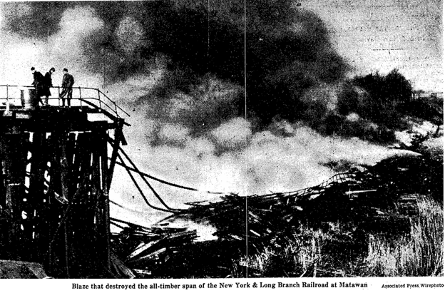
Fire destroyed the Matawan Creek trestle at dawn on 6 December 1946, causing a major disruption to regional commuter travel and commercial transportation along multiple railroad lines. The fire also brought down telegraph wires. Police and fire officials suspected arson as the fire appeared to have had three points of origin in the marsh piling. (d)
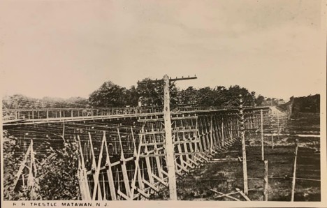
Figure 3 The single-track replacement trestle at Matawan.
The railroad quickly contracted to have a new single-track span built. Locals were hired and materials gathered from stations throughout the area for what became a marathon effort to produce a replacement bridge in only ten days. (d, e)
“The construction and regular railroad crews started work at 7:30 am Saturday Dec. 7. A peak number of 569 men worked in one 24-hour period during the 10 days. . . . The men were forced at times to work hip-deep in the frigid mud and ice-covered waters. . . . Work started at both the Matawan and Cliffwood sides of the trestle, with a railroad locomotive and work train at each end. . . . A full moon brought in higher tides than usual. But as the foundations were set and stringers and ties erected, the railroad men were laying track. . . . The last spike had been driven by 9:50 pm Dec 16 and the last fishplate buckled into place by 10:10 pm.” (e)
Riders became dissatisfied with the single-track trestle, so a plan was devised to replace the trestle with a two-track solid-fill crossing of the Matawan Creek meadow from Matawan Avenue in Cliffwood and Main Street in Matawan. (e)
A two-year $1 million project ensued, involving countless truckloads of soil to fill the gap. The existing trestle remained active during the project, requiring engineers to protect the active transit infrastructure. The project included the placement of conduit pipe to allow the creek to pass under the newly placed fill. (e)
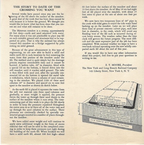
Figure 4 The Story to Date of the Crossing You Want, NY LB RR Co
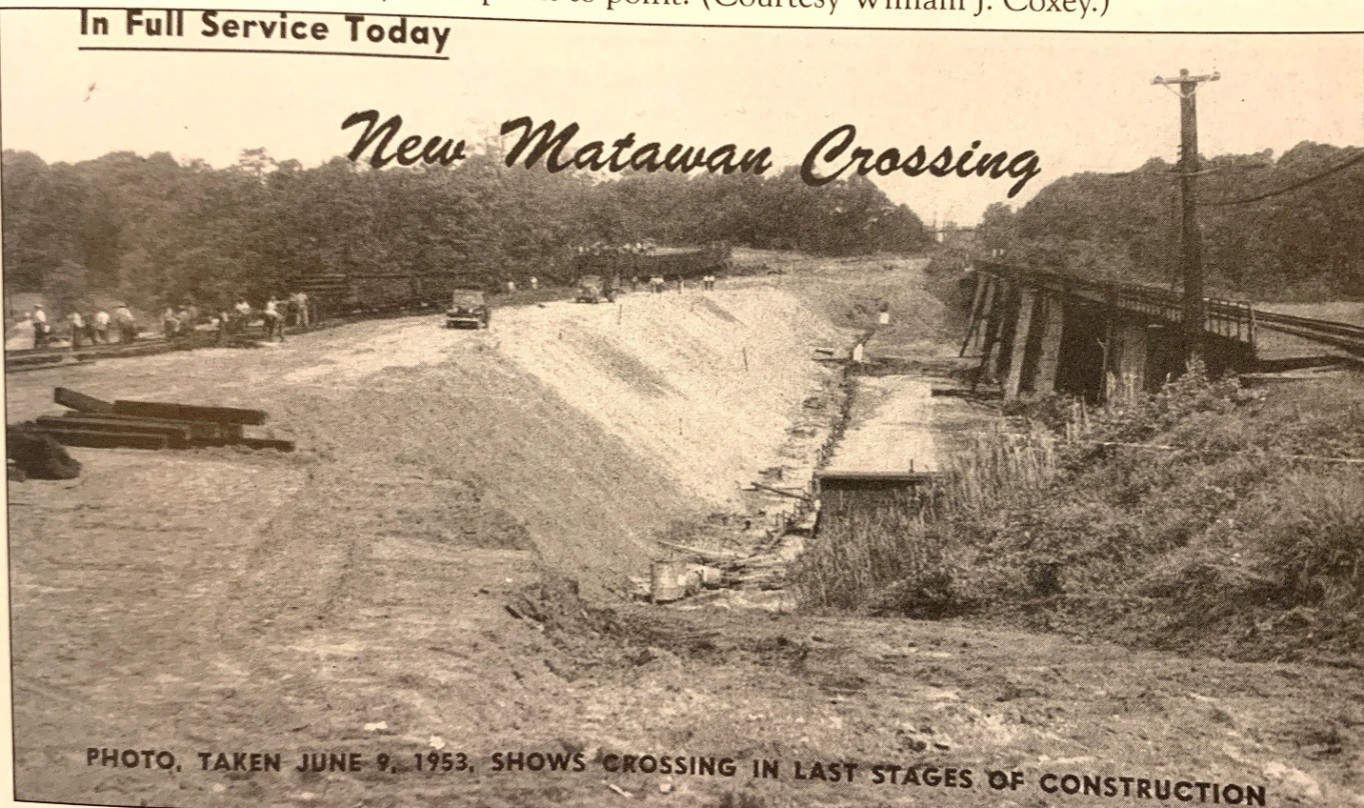
Figure 5 This photo shows the final stages of the fill project as of 9 Jun 1953
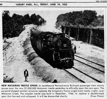
Figure 6 Trains Creep on New Span, Asbury Park Press, 19 Jun 1953
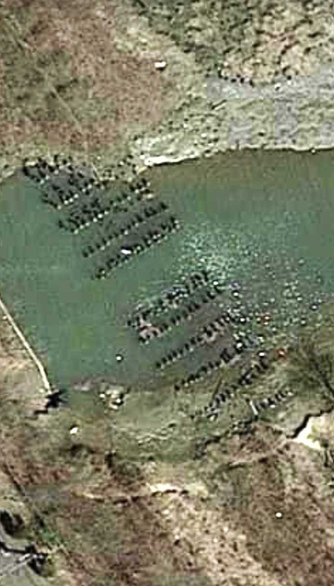
Figure 7 Remains of the Matawan Creek trestle can still be seen (Google Maps)
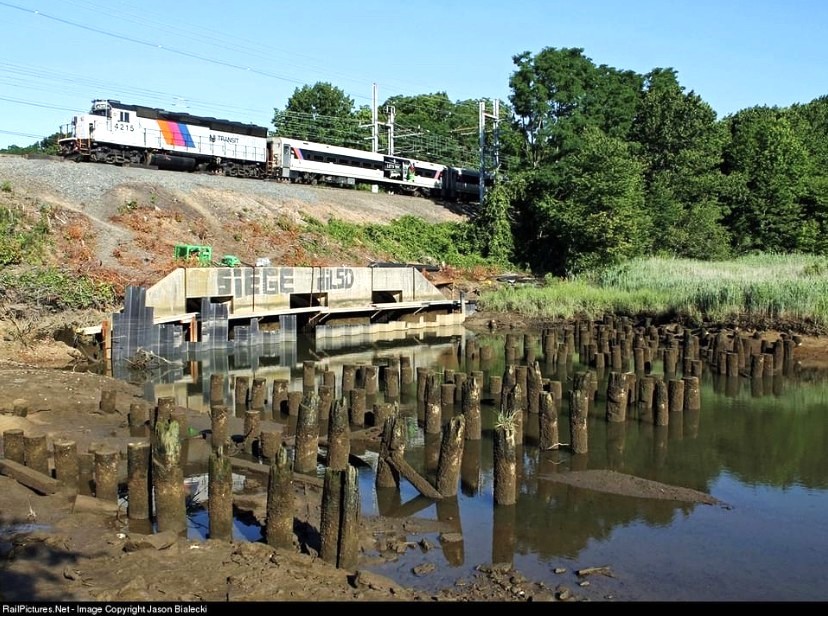
Figure 8 Photo taken 27 June 2012 (Posted by Joe Saggese on Facebook)
FOLLOW UPS
The history of commercial navigation into Matawan on Matawan Creek would be a worthy project.
The 7 Jul 1955 Matawan Journal includes a lengthy piece called “The Shipping Industry of Matawan, by Donald Flynn, which could be a useful resource.
An essay on the competition between Matawan and Keyport over the routing of the New York and Long Branch Railroad in 1875.
The new construction at the corner of High Street and Main Street obscures some local history in the vicinity of the old trestles that should be documented. There was a road off Main Street that serviced lime kilns along the creek and connected down the slope with High Street just past Bank Street. That alleyway was used by fire and rescue in emergency situations to go under the trestle to bypass the railroad crossing when it was blocked by a train in the station.
The references to Peter V Hyer’s farm and J H Hornor’s lime sheds need exploration.
SOURCES
a – Opening of the N Y and L B Railroad, Matawan Journal, 26 Jun 1875
b – No Draw at Matawan, Matawan Journal, 5 Jun 1875
c – Matawan Journal, 29 Mar 1929
d – Arson Feared as 3d Trestle Burns; 12,000 Jersey Commuters Delayed, New York Times, 7 Dec 1946
e – Matawan Trestle Reconstruction Race Recalls Railroad Sagas of the Old West, Asbury Park Press, 22 Dec 1946
f – Trains Creep on New Span, Asbury Park Press, 19 Jun 1953
NO COMMENTS